
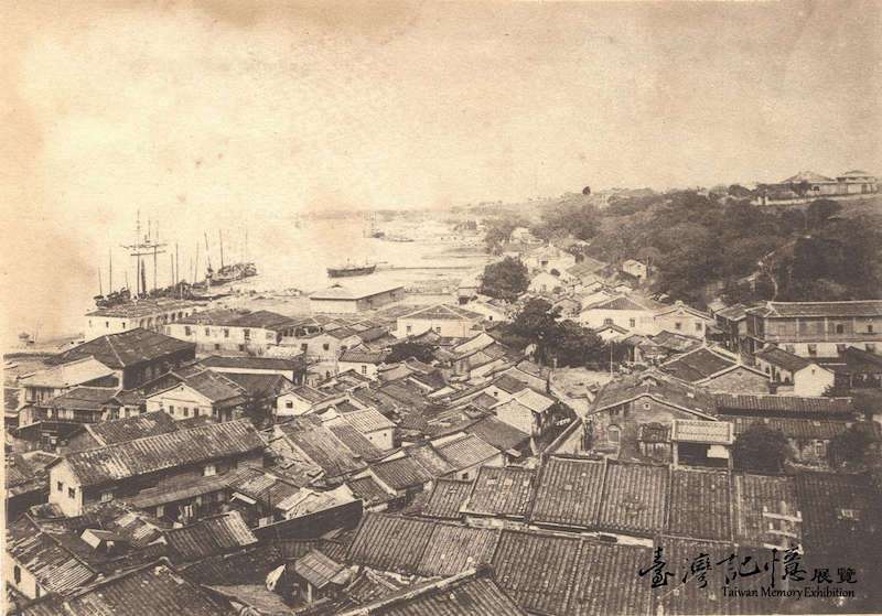
This aerial view shows row upon row of houses cramped together and ships coming and going in the background. How prosperous this area was at the time! This is a look at what the streets were like in Tamsui at the beginning of the Japanese occupation.
Tamsui used to be known as Hobe (Huwei) and was originally a small fishing port in northern Taiwan. Early in the 17th century, the Spaniards erected Fort San Domingo here. Tamsui then fell under the rule of the Dutch, the Kingdom of Tungning, and the Qing dynasty. In 1806, a port was built and international trade commenced. This catapulted Tamsui into both the gateway to northern Taiwan and an international commercial port. At the time, boats in the river and harbor were as numerous as Chinese carp and all of Tamsui was filled with foreign-styled buildings. In the picture, the buildings near the Tamsui River are mostly residences of foreign officers and Japanese-styled buildings. On the right side of the picture at the top of the mountain is the dormitory for those who worked at the customs office. The bottom picture shows buildings on Chongjian Street and Qingshui Street built along the mountain slope.
A View of Tamsui Streets at the End of the Qing
- NCL Special Collection / Li Dao-yi / Japanese Colonial Period (1895-1945) / 14.3×10.2cm / 《Visual Feast》